Hāmākua Open Space, and the nearby community of Ha’iku, are part of Hāmākualoa.

Aerial view of the acquisition made by the Maui County Council for the Hamakua Open Space.
Another satellite view of the Open Space, showing Lot 6, which will soon be part of it.


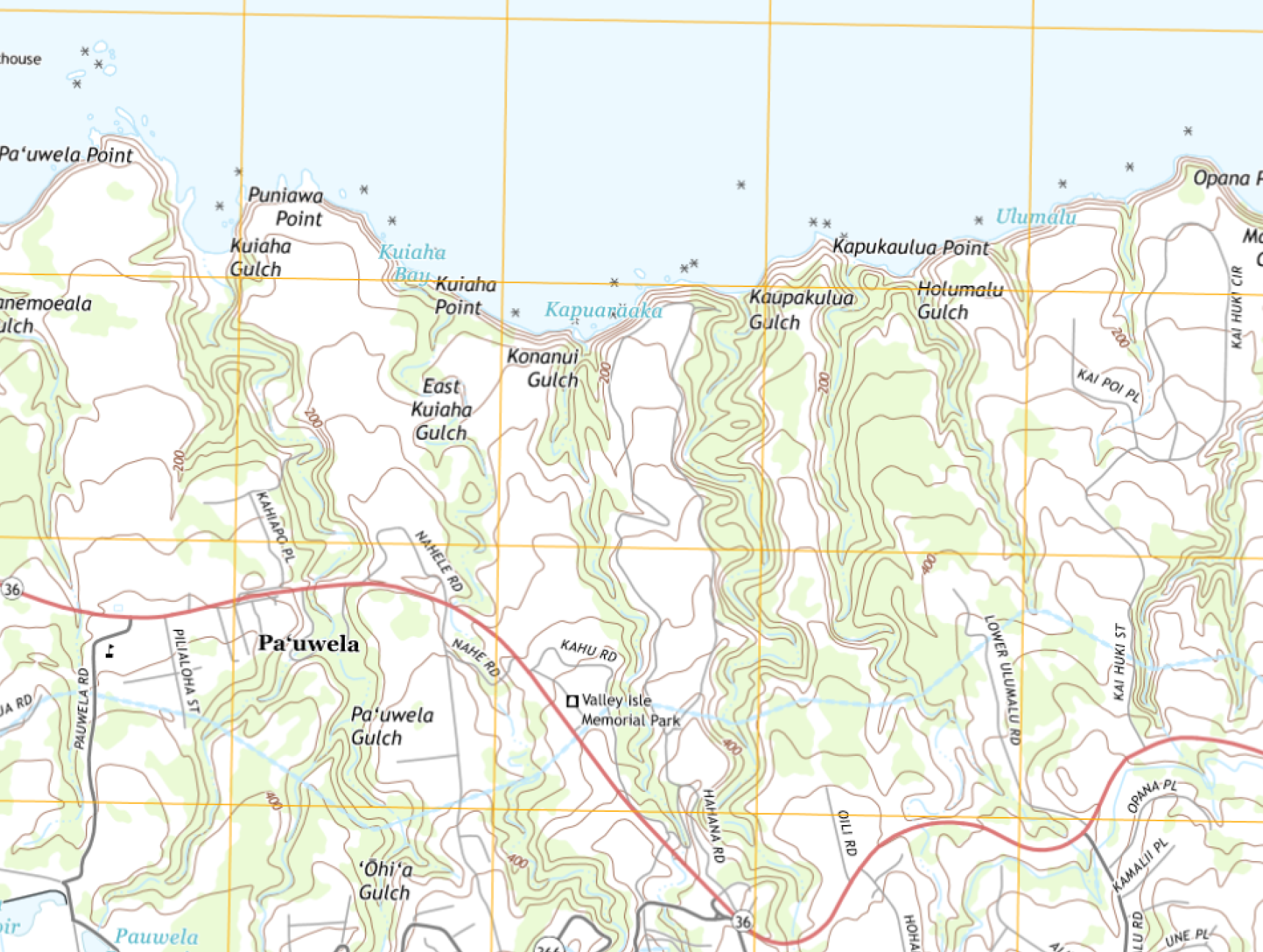
USGS topo map of the area showing the main gulches – East Kuiaha, Konanui, and Kaupukulua. The first two are in the Open Space, but Kaupukalua is just outside, to the east of the Open Space.
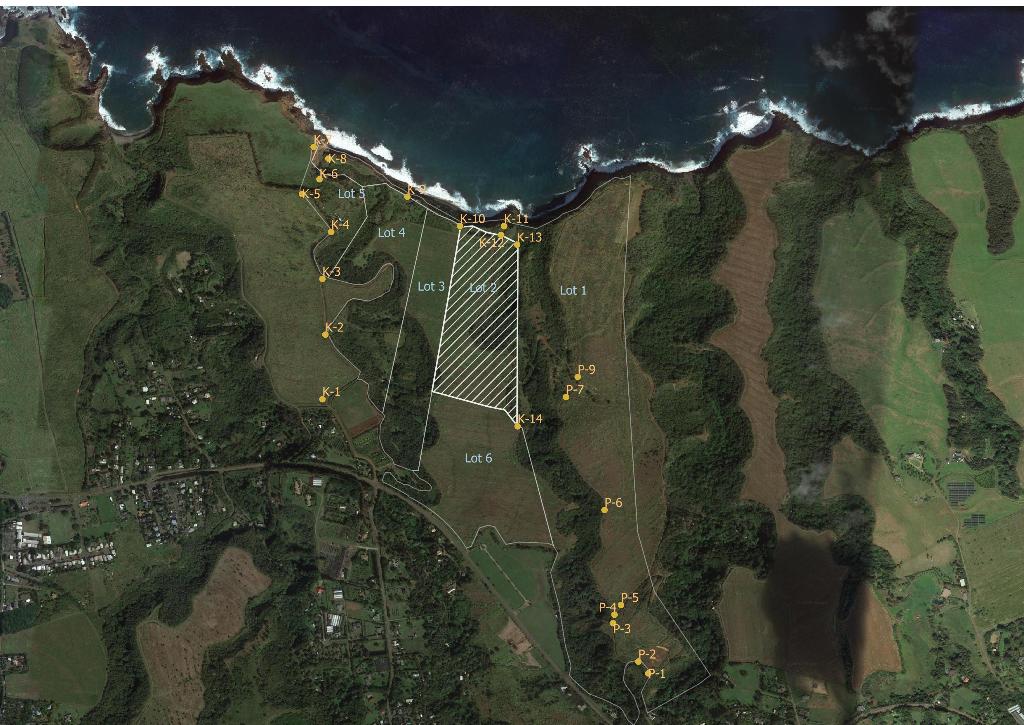
Map for placement of signs in Hāmākua Open Space. The county has asked MHM to help locate where roads and trails enter or leave the Open Space, as well as where boundary signs should be placed. This map includes Lot 6, which was acquired in September 2020. The shaded area is private land. Click on the image for a higher-resolution view.

